| Sea Ice Group at the Geophysical Institute |

|
|
Ice Observatories
We operate coastal ice observatories in the villages of Barrow and Wales, Alaska (shown in the map below). Both sites consist of a coastal webcam and radar. In Barrow, we also maintain a sea ice mass balance and sea level station, as well as produce forecasts for the early summer break-up of landfast ice. Near each site we also perform regular ice coring and ice thickness profiles (visit Data for more information). See below for general details and the menu at left for links to individual observing site components. |

|
Webcams
In addition to providing a visual impression of the sea-ice conditions off oberservatoy locations, webcam images establish a longer-term record of key dates in the seasonal evolution of the sea-ice cover, such as: onset of fall ice formation, formation of a stable ice cover, onset of spring melt, appearance of melt ponds, beginning of ice break-up in early summer, removal or advection of sea ice during the summer months.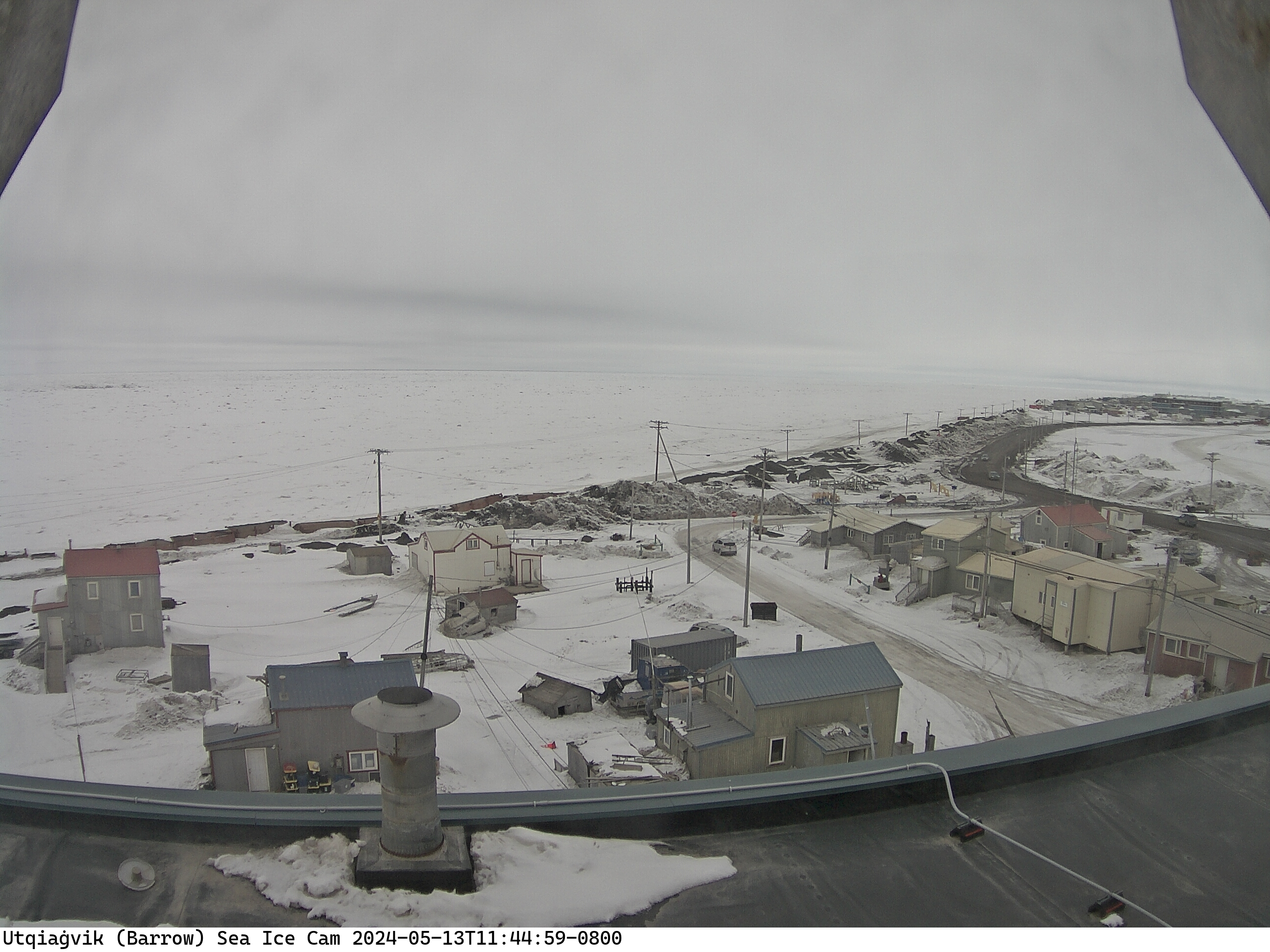
The webcam in Barrow is installed atop a 4-story building in downtown Barrow (71° 17′ 33″ N, 156° 47′ 18″ W). The camera is looking approximately NNW. The webcam in Wales is mounted on top of the Kingikmiut School at the base of Cape Moutain. The camera is looking approximately WNW. On a clear day, both Fairway Rock and the Diomede Islands are visible. Both webcam images are updated online every 5 minutes.
Radars
A ground-based radar system emits a rotating beam of energy that is reflected back to the antenna by the surface of sea ice, or waves on the ocean if sea ice is not present. The effective range of a coastal sea ice radar system depends on the elevation of the antenna above sea level. The sea ice radar at Utqiaġvik and Nome can detect sea ice at ranges of up to about 10km (6 miles).
In general, rough ice surfaces like ridges and rubble fields appear brighter than areas of smooth ice, which sometimes cannot be detected due to the low angle of incidence (see figure below). Buildings, fences, and vehicles on land can also return strong signals. Dark regions may indicate open water, but they might also indicate smooth ice or shadow zones behind large features. Atmospheric features, such as fog or rain, can occasionally be seen in the radar imagery as well. Every so often, even birds or caribou are picked up by the radar.
Iñupiaq Sea Ice Knowledge - Project Jukebox
Project Jukebox at UAF (Karen Brewster and collaborators) compiled interviews conducted with Iñupiaq sea ice experts from Barrow and neighboring communities, drawing on research by Matthew Druckenmiller, Dyre Oliver Dammann, Lewis H. Shapiro and others from our research group.
The interviews and additional information is available at the Project Jukebox website: Project Jukebox
Additional information
A detailed overview of the various components and research objectives of the Barrow Sea Ice Observatory are presented in the following paper:
Druckenmiller, M.L.; H. Eicken; M. Johnson; D. Pringle; C. Williams (2009) Towards an integrated coastal sea-ice observatory: System components and a case study at Barrow, Alaska. Cold Regions Science and Technology 2009, 56 (1-2), 61-72 . (pdf)
Acknowledgements
This project is supported through the Alaska Ocean Observing System (AOOS) with logistical and technical support provided by the Barrow Arctic Science Consortium (BASC) and the Native Village of Wales. We also gratefully acknowledge the Arctic Slope Regional Corporation (ASRC), the Bering Sea School District, and Kingikmiut School for supporting installation of the webcams and radars. This material is also based upon work supported by the National Science Foundation under Grant No. OPP-0632398. Any opinions, findings and conclusions or recommendations expressed in this material are those of the author(s) and do not necessarily reflect the views of the National Science Foundation (NSF).
The sea ice radar is supported through the DHS National Center for Island, Maritime, and Extreme Environment Security (CIMES).