| Sea Ice Group at the Geophysical Institute |

|
|
Barrow Sea Ice Mass Balance Site 2008
Results below from equipment on first-year, landfast sea ice offshore of Niksiuraq, the hook at the end of the road to Point Barrow. The latest recorded measurements are:
| Jun 17, 2008, 10:00 | Air Temperature: 32°C, 0°F |
Ice Thickness: 3 ft 2in 0.96m |
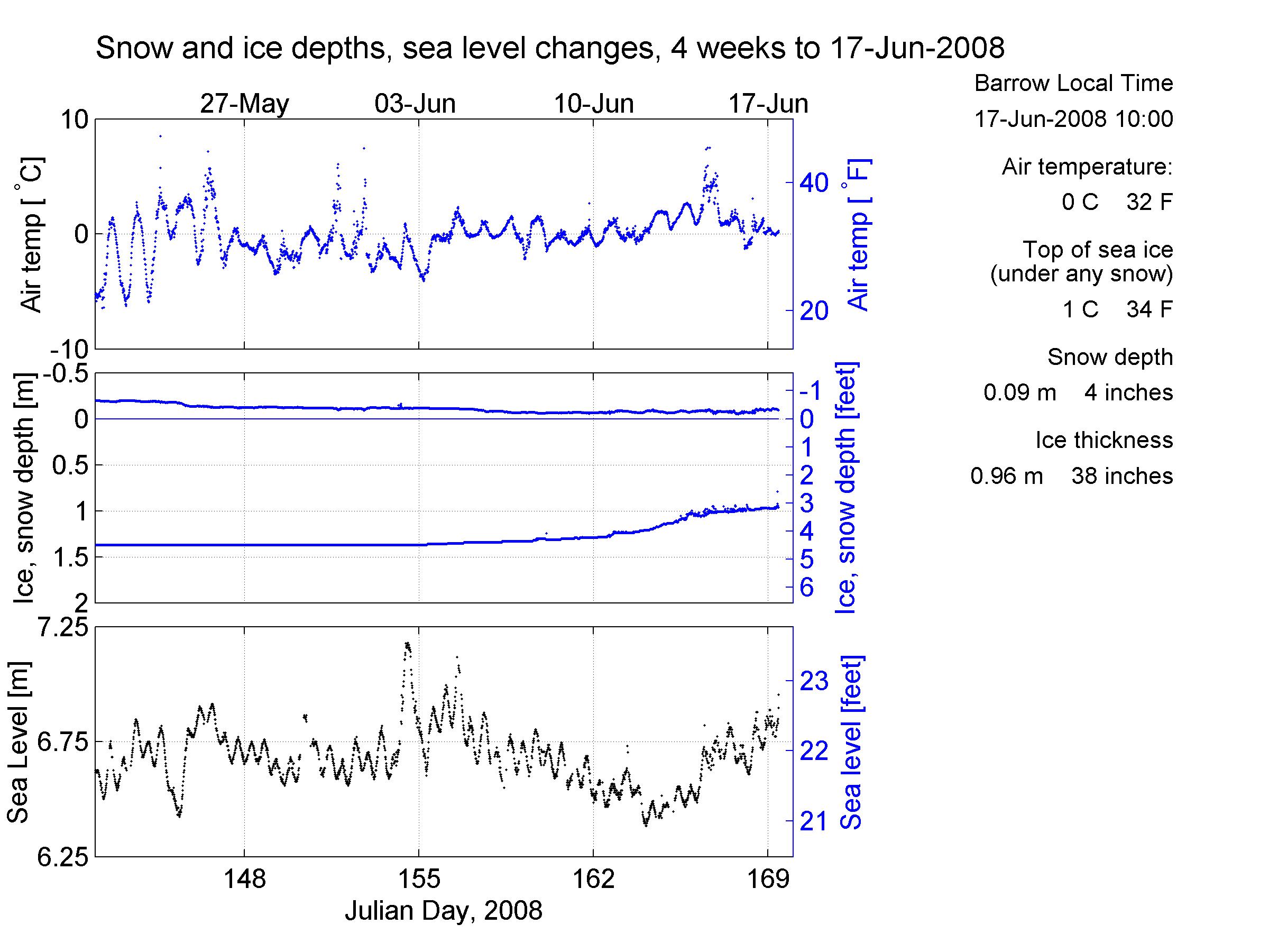 |
Air Temperature | Snow and ice depth | Sea LevelClick the image on the left, or here for the last 4 weeks of air temperature, snow and ice thickness and sea level. Links: | measurements from whole season | a guide on how to read the figure . | |
 |
Ice and Water TemperaturesClick the image on the here , or here for the last 4 weeks of ice and water temperatures. Links: | measurements from whole season | a guide on how to read the figure . | |
Shown here are changes from average sea level over the last 4 weeks.
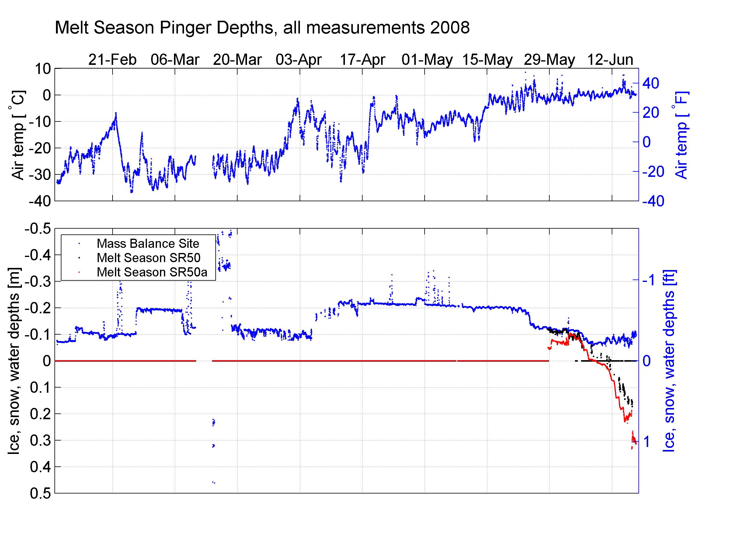
• Melt season pingers and whole season.
Mass balance site snow depth sounder + two pingers added in melt season to look at pond and surface ablation.
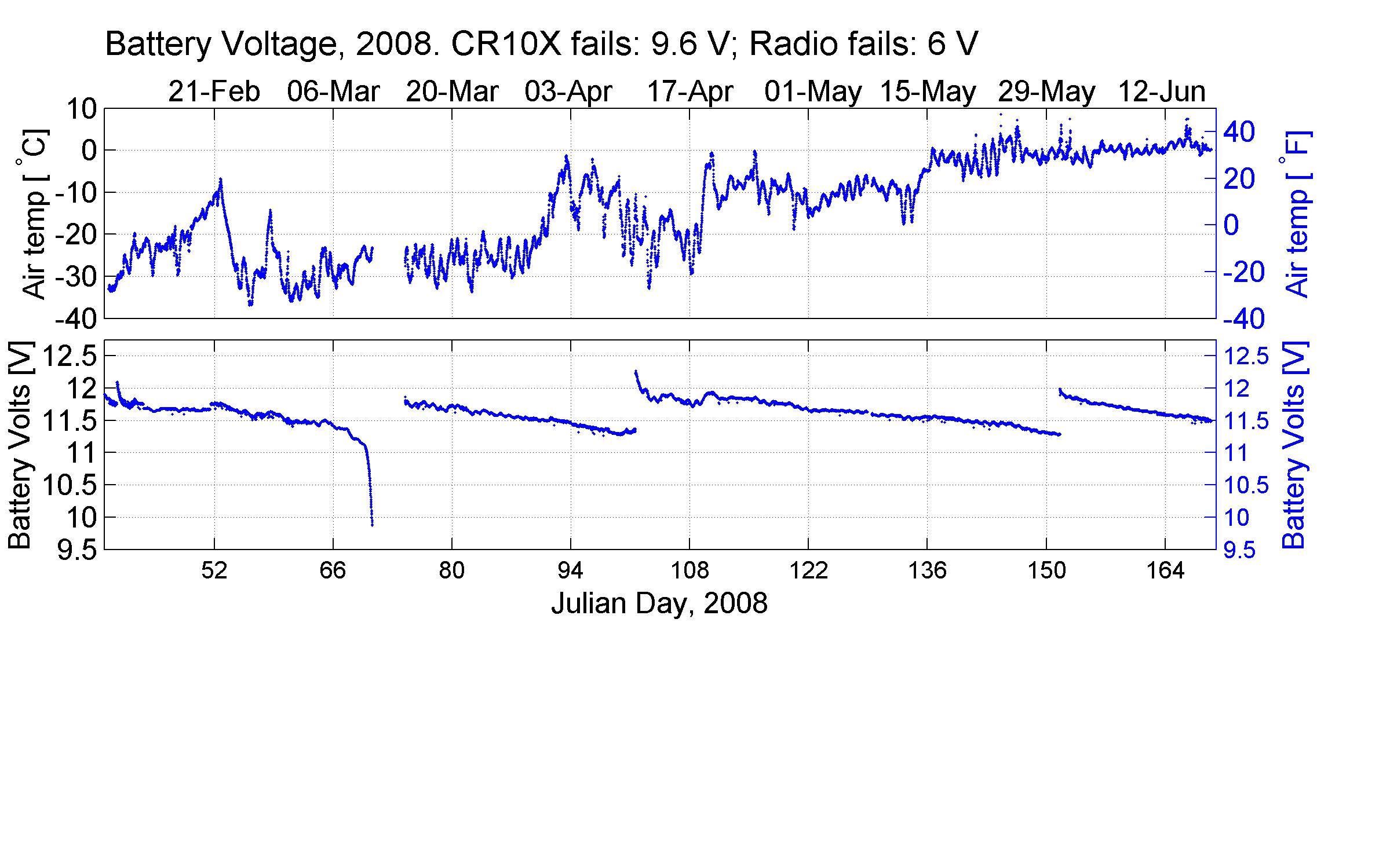
• Battery voltage and air temperature.
Voltage drops quickly past 11.25 V. The CR10X logger needs 9.6 V, and FreeWave Radio 6 V.
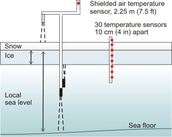 |
Equipment and MeasurementsClick the image on the left, or here for sketch of measurements. A full list of measured quantities and devices can be found in the 2008 metadata file . |
Acknowledgements
This project is supported through the Alaska Ocean Observing System (AOOS) with logistical and technical support provided by the Barrow Arctic Science Consortium (BASC). We also gratefully acknowledge the Arctic Slope Regional Corporation (ASRC) for supporting installation of the webcam and radar. This material is also based upon work supported by the National Science Foundation under Grant No. OPP-0632398. Any opinions, findings and conclusions or recommendations expressed in this material are those of the author(s) and do not necessarily reflect the views of the National Science Foundation (NSF).