| Sea Ice Group at the Geophysical Institute |

|
|
Barrow Sea Ice Mass Balance Site 2007
|
The data here came from a site on first-year landfast sea ice at 71° 22' 25.36" N, 156° 32' 30.91" W, offshore of Niksiuraq - the hook at the end of the road to Point Barrow. The site used a FreeWave spread spectrum radio to transmit data to the Barrow Arctic Science Consortium (BASC) for forwarding to the Alaska Ocean Observing System (AOOS) data management team at the Institute of Marine Science at UAF. The following measurements were recorded: (i) snow and ice thickness and local sea level; (ii) temperature profile through air-snow-ice-water; (iii) air temperature and relative humidity at 2m above the ice; (iv) developmental sea ice salinity measurements with dielectric probes. Battery voltage plot here. The CR10X stops recording new data at 9.6 V; the radio transmits down to 6 V. |
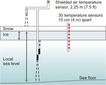 Sketch of mass balance site measurements |
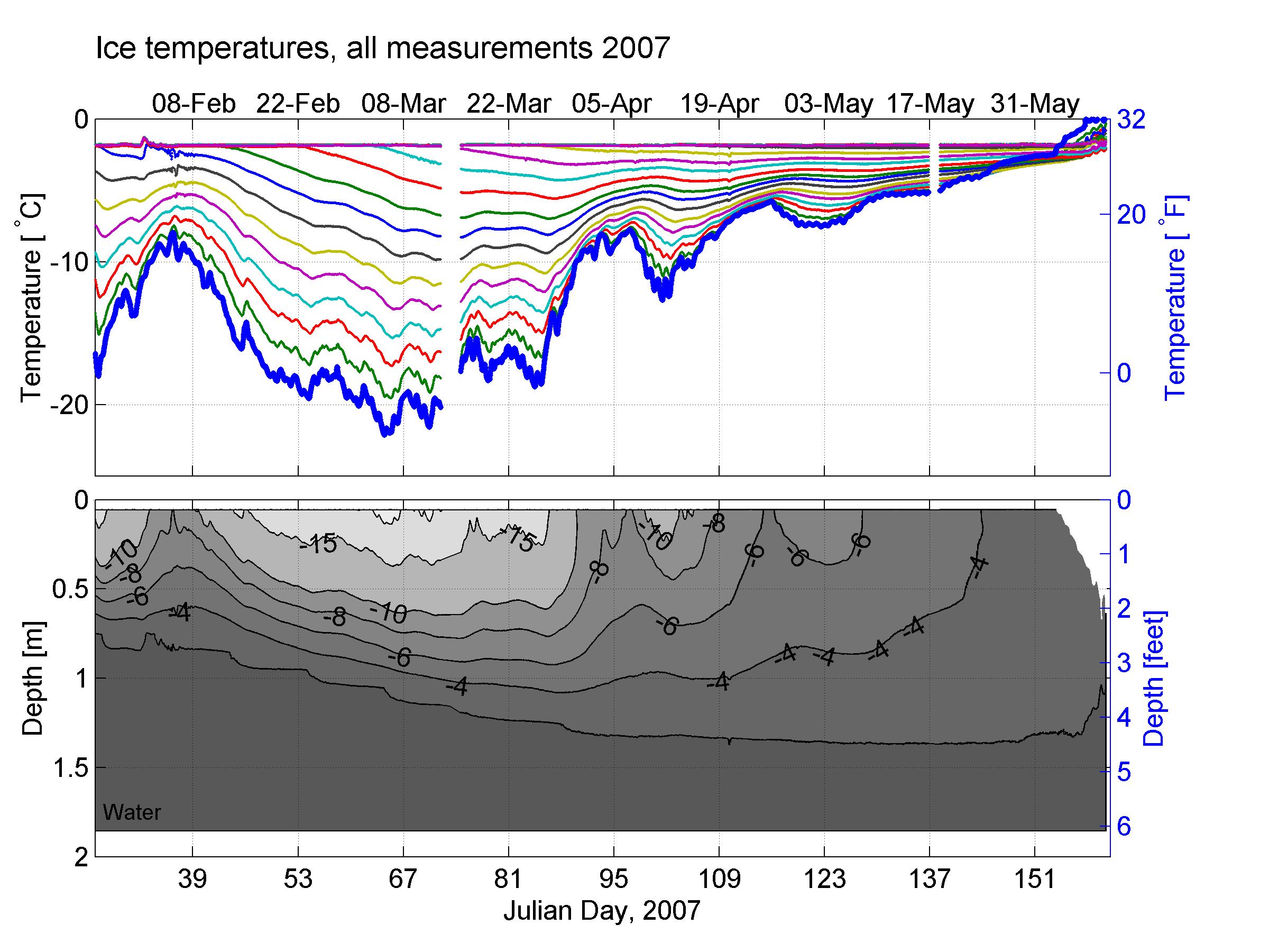
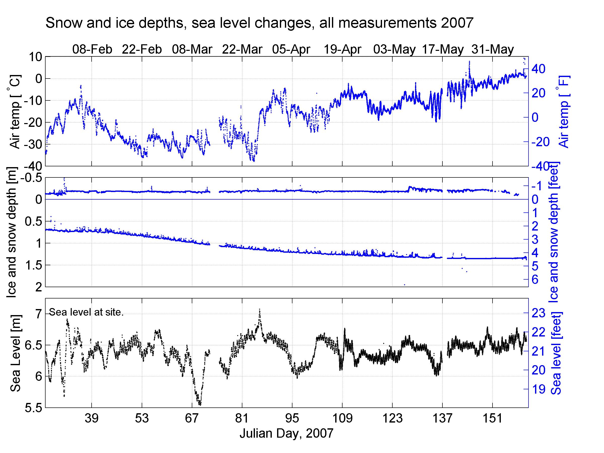
Data from entire season: January - June 2007
For best resolution, click on the figure and it will open at full resolution. To save, right click and choose 'Save image as'.
 |
 |
Data from the last month
Below are data from the last month of measurements. For best resolution, click on the figure and it will open at full resolution. To save, right click and choose 'Save image as'.
 Last 4 weeks of air and ice temperatures. For a guide on how to read this figure, click here. |
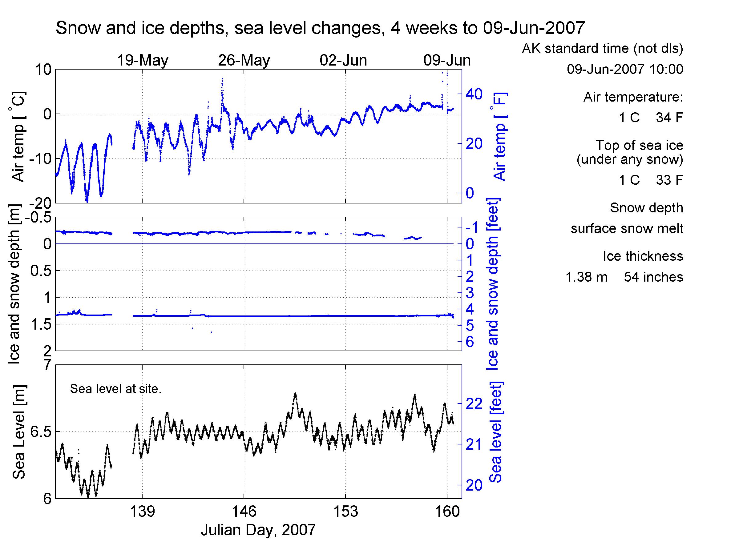 Last 4 weeks of snow and ice depths and local sea level variations. For a guide on how to read this figure, click here. |
Data sets or details of measurements are available by contacting Daniel Pringle